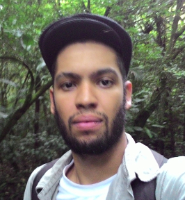
I am a Senior Researcher at BAW Research (Federal Agency for Water Management, Austria), working on ecohydrology and remote sensing of evapotranspiration. I hold a PhD in Forest Engineering from the Universidade Federal de Santa Maria, Brazil, and was a postdoctoral researcher at the Institute of Hydrology and Water Management (HyWa), BOKU University, Vienna.
My research looks at how land use, soil management and nature-based solutions shape the water balance, water quality and ecosystem services of agricultural and natural landscapes under climate change.
News
- Oct 2026New first-author paper in Frontiers in Sustainable Food Systems on natural ecosystem loss and land-use change in an Atlantic Forest agricultural basin. DOI
- Oct 2026Taught an 8-hour introductory course on SWAT+ watershed modelling at SNCT 2026, IFBA Vitória da Conquista, Brazil. Read the course guide (em português)
- Jul 2026Co-authored study on climate change impacts on low-flow extremes in a Croatian catchment (SWAT model), presented at the 5th International Congress on Earth and Geological Sciences, Vienna. DOI
- Jun 2026First meeting of the VeSchN advisory board at the Burgenland water management office.
- May 2026Paper in the European Journal of Soil Science on climate impacts and no-till for winter wheat across Europe. DOI
- Apr 2026VeSchN project kick-off at the Biological Station Illmitz, Lake Neusiedl.
Current work
- VeSchN - Reed evapotranspiration at Lake Neusiedl (2026-2028): a BAW Research and Forschung Burgenland project funded by the Austrian Federal Ministry (BMLUK) and the Land Burgenland. I contribute to the remote sensing component: estimating evapotranspiration of the reed belt from Sentinel-2 imagery (OPTRAM-ET), comparing global ET products in Google Earth Engine, and evaluating satellite estimates against field measurements.
- Topic Editor, Frontiers Research Topic Watershed/landscape scale ecosystem services and Land Use for Sustainable Agricultural Food Production.
Software
- Rainfall Erosivity Monitor (Python, Streamlit): web application that computes the EI30 rainfall erosivity index from GeoSphere Austria station data, detects erosive storms and issues colour-coded soil-erosion alerts with field survey recommendations. DOI
- QField erosion survey: field guide and QGIS/QField project for mapping soil erosion by water following the DWA-M 921 guideline (German and English). With G. Liebhard, T. Brunner and P. Strauss. DOI
Research interests
- Remote sensing of evapotranspiration and wetland hydrology
- Hydrological and water quality modelling (SWAT, APEX)
- Soil management, land-use change and climate adaptation
- Nature-based solutions and ecosystem services
Recent publications
- Lima, E. M., Mehdi-Schulz, B., & Reichert, J. M. (2026). Natural ecosystem loss in an Atlantic Forest agricultural basin: drivers of land-use change and future landscape trajectories. Frontiers in Sustainable Food Systems, 10, 1912707. DOI
- Meurer, K. H. E., Turek, M. E., Pullens, J. W. M., Lima, E. M., et al. (2026). Site-specific climate impacts outweigh no-till benefits for modelled winter wheat yields across a European gradient. European Journal of Soil Science, 77(3), e70363. DOI
- Turek, M. E., Pullens, J. W. M., Meurer, K. H. E., Lima, E. M., et al. (2025). Pedotransfer functions versus model structure: what drives variance in agro-hydrological model results? European Journal of Soil Science, 76(2), e70088. DOI
Full list in my CV and on Google Scholar.
Computing
- Programming: R, Python, SQL
- Remote sensing and GIS: Google Earth Engine, Sentinel-1/2, Landsat, MODIS, LiDAR, QGIS, ArcGIS
- Modelling: SWAT, APEX, InVEST
- Reproducible research: Git, Quarto, R Markdown, Linux command line